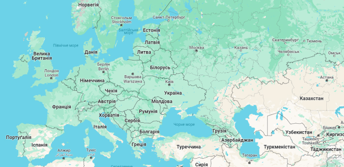
Ukraine is a country located in the central part of Eastern Europe at the intersection of transportation routes from Europe to Asia and from the Scandinavian countries to the Mediterranean region.
Ukraine shares borders with seven countries:
- To the north: Belarus
- To the west: Poland, Slovakia, and Hungary
- To the southwest: Romania and Moldova
- In the east: Russia
The territory of Ukraine stretches from west to east for 1,316 km and from north to south for 893 km.
Here are some key geographical characteristics of Ukraine:
- Total area: 603,628 square kilometers (46th largest in the world)
- Land borders: 5,638 kilometers.
- Coastline: 1355 kilometers (Black Sea – 1056.5 km; Azov Sea – 249.5 km; Kerch Strait – 49 km).
- Highest point: Mount Hoverla (2061 meters above sea level).
- Lowest point: Kuyalnyk Estuary, Odesa region (-5 meters).
Ukraine has a diverse landscape, which includes the Carpathian Mountains, Podillia Upland, Dnipro Lowland, and Black Sea Lowland.
Ukraine also has a rich water network, which includes:
- Rivers: Dnipro, Southern Bug, Desna, Dniester
- Lakes: Shatsk Lakes, Synevyr, Lemurian, Svityaz, Nesamovyte
- Seas: Black Sea, Azov Sea
Ukraine is a unitary state. It consists of 24 regions and the Autonomous Republic of Crimea.
Where is Ukraine on the world map?
Ukraine’s geographical location makes it an important transportation and economic center. The country has access to the Black Sea, which gives it access to global waterways.
Ukraine is also rich in natural resources, such as coal, iron ore, manganese, natural gas, oil, and agricultural land